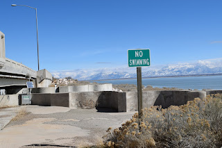
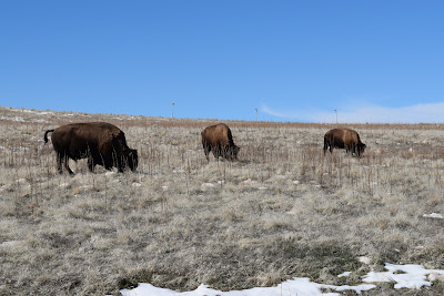
Friday, March 2, 2018

Antelope Island


I've been somewhat fascinated by the idea of this place ever since I found out about it.  The first day we arrived in the Great Salt Lake Valley I was looking for something for Kristi and I to do.  I wanted to see the Great Salt Lake.  I've been hearing about it for a long time and it was one of the reasons I agreed with Kristi to come here on some extra days we had on our tour.  As I was looking online for a place to approach the lake, it almost seemed to me that we were not really welcomed to actually visit the lake, and then I found Antelope Island, and Antelope Island State Park on Google Maps.  The map showed an island out in the middle of The Great Salt Lake (GSL), and really no way to get to the island if we didn't have a boat.  There was a state park there though, and I assumed that it would be on the lake.

Kristi agreed that it was a good idea to try to get to the lake somehow and we got in our car and started to drive.  It was a chilly winter day.  No matter, we were determined to see the GSL close up. We drove through town (we were staying in Layton) quite a distance, but it all seemed like the same suburban town, and as we got closer to the lake there were new housing developments, and lots, and lots of shopping.  Then there was a road and a gate, and a guard shack where we were asked for an admission fee, which being seniors (over 62) was $5.  Now, mind you, we still had no idea what the park consisted of.  Once we got past the gate guard we were on a causeway, a lake fill with a road on it and we drove the 7 miles out to Antelope Island.

Once on the island we found a place where there was beach access and walked across a rocky terrain down to the beach where we admired the sun trying to shine through a gray winter sky.  There was sand of a texture that I had not experienced before, and the lake water was calm.  There were snowy mountains on all sides of the lake, and a bison standing on the beach.


The 7 mile causeway was built started in 1967, and finished in 1969.  On the way out the causeway for our first time we saw several hawks hunting in the grasses by the road.  The water was low for much of the way with a snowy beach that extended out quite a ways.  As we got closer to the island the water got higher.  We crossed two bridges on the way out that allowed water to flow from one side of the causeway to the other.

After a short stay on the beach we visited the "visitors center" where we found out a little more about the island.  The island had been a ranch since 1848, and most of the game that was originally on the island had vanished and the native grasses had been destroyed by grazing cattle and sheep.  The state bought the ranch in 1981 and restocked the island with California Bighorn Sheep, and pronghorn antelope,   There has been a bison herd on the island since 1893 when a dozen bison were purchased from one William Glassman by then owners John White, and John Dooly and there has been a Bison herd on the island ever since.  The herd now numbers between 500 and 700.

After the "visitors center" we drove out to the aptly named "Buffalo Point" where we saw our first bison.  There is a nice view from there.  As I said before it was a chilly day, and it was 4 pm when we got there.  By this time it was after 5 pm and the park closes at 6 pm so we were thinking it was time to call it a day.

Our First Bison Sighting
There is a warning at the gate to the park that "Bison may be dangerous".  We didn't get close enough to them for them to be any danger, but I know how powerful wild animals are and have been very careful.


We left the island that first day with the resolve that we would return the next day, which we did.  The next day it was overcast but a bit warmer.  I was determined to see some wildlife, and there was a lot more island to see.  It is 15 miles long, and though the road doesn't go all the way down to the south end of the island, it goes down to the old ranch a little past the middle of the island.  We didn't get too far down the island before we sighted a small herd of bison.  I stopped to take pictures even though they weren't close to the road, and I wasn't set to walk over to them knowing that they can be dangerous.


We drove down the island to Fielding Garr Ranch, established in 1848.  There are a number of buildings on the ranch including the ranch house, built in 1848, and is "the oldest Mormon-built home that is still on its original foundation, in Utah."  There are several pieces of farm machinery around, and a shop with signs on the wall to give you a sense of the history of the place.  Apparently the water levels of the lake allowed people to take wagons, and animals out to the island across the lake sand until 1854 when the waters of the lake were too high and they built a boat to access the island.  There are fresh water springs on the island fed from the hills rising above the lake from the island.


The ranch was sold to various people over the years and was primarily a cattle and horse ranch until 1915 when the owner changed to sheep ranching.  All of this depleted the native vegetation which is currently being restored.  The park is "home to jackrabbits, pronghorn, bobcats, mule deer, coyotes, and several species of rodents. The island and Great Salt Lake attract migrating birds. The inland grasslands on the island provide habitat for chukars, burrowing owls, long-billed curlews and several species of birds of prey"


If you look closely at these pictures you can see where this ranch house has been built onto.  At the very end of the house is a bathroom with a shower and and indoor toilet.  Improvements came slow to the island.  There is documentation describing the introduction of electricity to the island, how they subsisted before there was electricity etc.


Kristi and I lived on the Key Peninsula for 9 years and the history of Key Peninsula is sometimes similar to the history of Antelope Island, although Antelope Island is very much closer to an urban setting than Key Peninsula is.  It is the history of progress coming to the local islands etc. that don't have immediate access to the amenities that are available on the mainland, so visually apparent, but so far away across the water, or through (in the case of Key Pen) the woods.

If this raven turned around you would see a small mouse in his beak.

As we were leaving the Island after our second trip out there we stopped at the first bridge you cross after leaving the island.  I got out of the car and walked along the bridge because I wanted to see just how much water was being allowed to go under the bridge.  I also wanted to take a few pictures.  When I got back to the car Kristi was out of the car carrying her camera.  She had seen a coyote crossing the bridge. [ (from Kristi): Steve had just asked the rhetorical question of whether animals ever make their way from the mainland out to the island on the causeway.  So there was our answer.  This coyote was trotting past our car, right down the center line of the asphalt and tempting fate.  I was fearful of it's safety as a car came along and slowed for it, then followed by an impatient truck-driver.  The coyote survived, apparently by following the shoreline by the causeway.  Here was an example of an animal who decided this life wasn't destined to be home sweet home and was making his exit.]   Driving off of the island we almost ran into a big hawk with about a 4 foot wingspan.
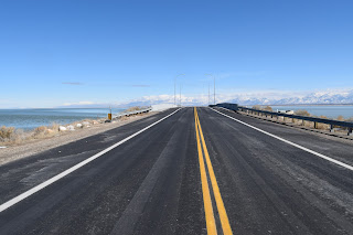
Coyote Alley
Our plans were to go to Pocatello, Idaho after Salt Lake.  We were scheduled to arrive around 5 pm on Wednesday so we had the better part of a day to use before heading up there as it is only about a 2 hour drive to Pocatello.  Both of us decided to make one more trip out to Antelope Island as it was a sunny day and picture taking would be better.  I also was hopeful that we would see more bison, and maybe even some other animals that we hadn't seen before.

Driving out to the island on Wednesday we stopped at the bridge again.  I wanted to take an even better look at the water under the bridge,  The water was a bit murky, but I was able to get a look at some of the plant life, which seemed to have some appeal to me.


We stopped at one point to watch a herd of bison from a distance.  Two sets of the big boys appeared to be having fights over one or two of the girls.  We watched them butt heads repeatedly, follow each other for a few steps and go at it again.  I hope they have hard heads.  It appeared one bison was watching intently from a distance while the rest of the herd walked away; maybe she was the desired one, making her choice.  (Kristi's description of the fighting boy buffalo)

Going onto the island we got a closeup look at some bison.  We took some pictures from the road.  They really didn't pay much attention to us, neither posing, nor going away from us.  They remained intent on feeding themselves.  There must have been some good food there.  We observed some birds that were apparently finding something good to eat on the backs of the bison.


Birds on Bison
I think that part of my fascination with this place is the fact that it has had failed homesteaders, miners, oil wells, cattle, horses, sheep, corporate ownership, church ownership, federal ownership, and now a state park.  It has been torn up, monetized, deserted, and now it is being restored (as much as possible) to it's former natural glory.  I think about the coal air pollution in London, the polluted Thames River, the rivers of the east, and midwest that have been totally polluted and then restored to being, if not cleansed, at least made cleaner.  We drove up to the viewpoint at Buffalo Point, this time to the top and stood for a long while looking out at the vista.  The combination of the mountains on the island, mountains on either side, and the GSL makes for some real beauty.


Kristi asked me what this thing on the Fielding Garr Ranch was:


I found this sign on the wall of the shop.


For a synopsis of island history:  https://stateparks.utah.gov/parks/antelope-island/antelope-island-history/

I hope you enjoyed reading.  Kristi and Steve Nebel

Thursday, March 1, 2018

Such a Great Lake


When I was a child my wonderful parents took me and my brother to the Great Salt Lake for a campground stay.  I recall the sulphurous smell, the freakish salty flat ground, and most of all the fun of swimming in buoyant water that seemed to bounce me to the surface without the help of an inflated toy.  In 2006 I made my first return via a commercial airline that landed in Salt Lake City.  The plane took off again in a clear and sunny sky, and flew directly over the long expanse of the great lake in February.  The image remained in my memory of the surreal colors of the lake and it’s surrounding shores.  I recall orange, cobalt blue, aquamarine blue, green, white, yellow, and it occurred to me that these were far from any ordinary colors I associated with lakes in North America.  

Finally I put the pieces of the puzzle that would answer my questions together on this visit to the lake.  The orange is the tall grasses that grow on the shores of the lake.  The yellowish green is the algae distinctive to the minerals in this unique lake that has no water outlet to clean itself.  That also accounts for the unique smell I recognized from my childhood.  The palest blues are various shades of ice, along with the white which is also an accumulation of snow on ice.  

I found it still to be an endlessly wondrous sight to behold.  This time I discovered more that explained some of the geological oddities I observed from the air.  The lake once covered an expanse of land that made the surrounding Wasatch Mountains into islands.  As we drove out of town heading for Pocatello I learned to look into the base of the alluvial fans of the mountains for signs of where the lake had previously been, high up into the hills.  The great Salt Lake once was unimaginably greater, though it’s possible to imagine with the help of the Natural History Museum at the University of Utah.  There you can crank up a pool of water into a tank which is arranged with the sculpted replication in miniature of the Wasatch Mountains, and thus see what it looked like 10 – 20,000 years ago.


Driving out of town I saw one of the alluvial fans scraped bare to harvest gravel for asphalt.  The red rocks were exposed as if the skin had been rubbed off to reveal blood below.  I thought about all the asphalt I take for granted every day and where it came from.  I guess in Washington these visages are protected from the average driver.   And then I thought about Butte, Montana as I saw it from our entry on a clear day driving on the I-90 freeway.  From a distance I saw a vast vista of great hillsides that had been mercilessly blasted to ruination amidst the beauty of their surrounding mountains.  Somehow the shock left a sense of offense within me that left me with the feeling that one of my personal relations had been injuriously and permanently violated.  Now we’ve seen portions of Montana, Wyoming, and Utah as we’ve driven through each, poked, scraped, blasted, pounded, and sucked dry of life with hundreds and thousands of oil drilling, hard rock mining, and fracking stations.  I’ll leave it at that.